
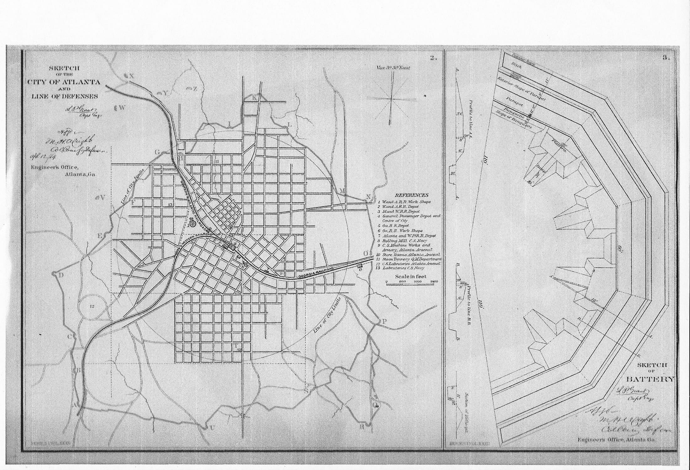
There will be a tours and a whole battle event (July12-20). Note that this map was signed by L.P.Grant who designed the fortifications of the city of Atlanta. It shows the City of Atlanta in 1864 which is what downtown Atlanta is today. The City Limits are indicated by the cycle that radiates from the zero milepost in today’ s Underground. It also shows a battery section of the fortifications, similar to what existed at Ft. Walker on Boulevard (Q on the large map) by the Zoo as well as at the outpost where The Roosevelt is today. P on the map is the hillside where the Arts Exchange and the Old Stockade (GlenCastle) is today.


Comments are closed.